| Home | ||
|
Recent Activities |
The Name |
Mountain Walks |
|
Pilgrim Walks |
Fell Walks |
Coast Walks |
|
Other Walks |
Strolling |
Hiking Statistics |
|
Narrowboating |
River Cruises |
Travel |
| Cornwall | Cathedrals | Copyright |
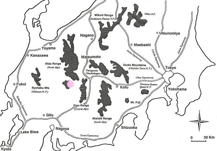
Ontake - August 1988
Location: West of Kisofukushima, Nagano PrefectureTransportation to Start Point: 4.5 hours
by car
|
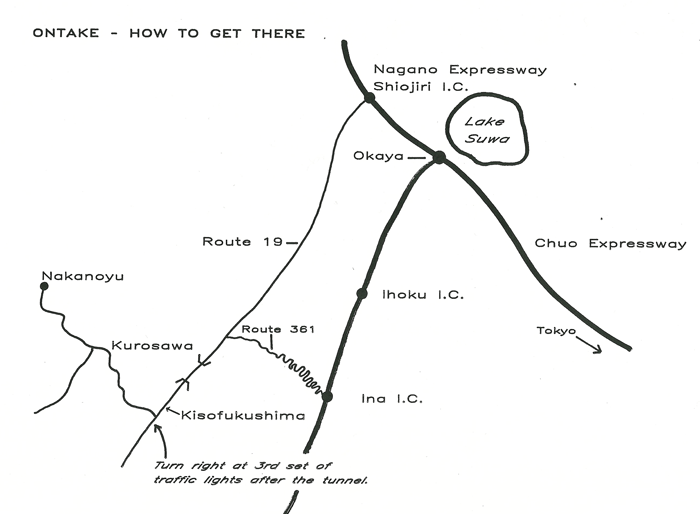
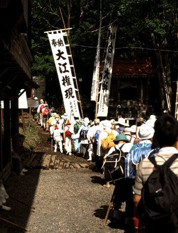
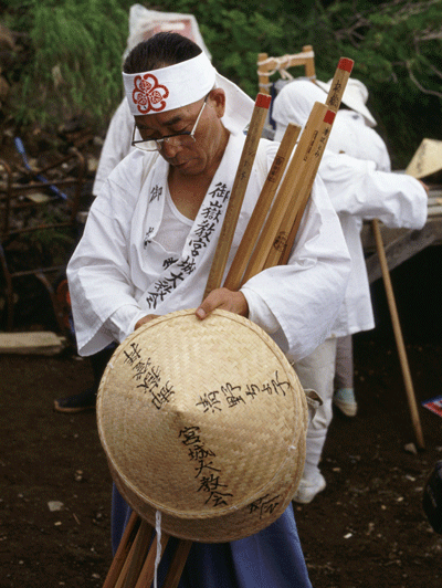
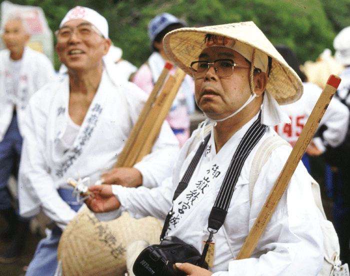
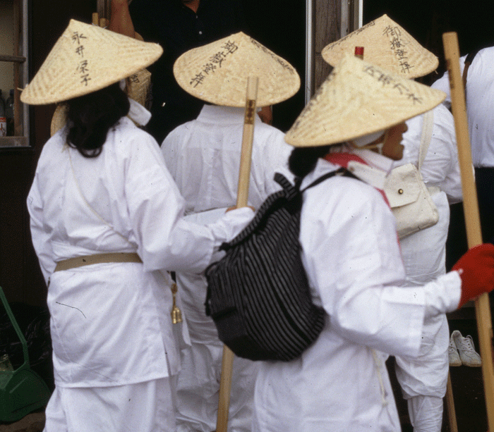
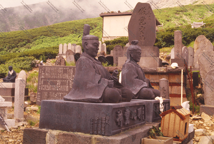
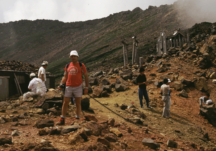
Determined to climb Ontake in a day and be back in Tokyo in the evening, Phil Rowcliffe and I set off by car along the Chuo Expressway at 4-15 a.m. Not having been to Ontake before we elected to take the Chuo Expressway as far as Ina, the second interchange past Okaya/Lake Suwa, and then take Route 361 to link in with Route 19 just before Kisofukushima. Exiting at Ina we turned right on to the 361, swinging off to the left some 2 miles or so along the road. From here the 361 climbs rapidly through an incredible number of hair pin bends with spectacular views of the valley below. The hair pin bends go on and on, and it is not long before you are convinced that you are on the wrong road! However perseverance brings you to the summit of the hills, and you drop rapidly into the valley the other side. A really enjoyable ride through beautiful countryside. Eventually you reach a "Y" junction in the road, both ways being sign posted Route 19. We took the right hand road as we were heading south on Route 19 to Kisofukushima. After passing through several tunnels we reached Kisofukushima and swung off into the valley leading to Nakanoyu to the West. You soon come to realise the religious significance of the area as the road is dotted with grave stones and shrines right the way up to the car park at Nakanoyu.We were ready to climb by 9-00 a.m. and set off up the steep staircase of logs which make the early part of the climb much easier. We were surprised to see the number of people making the climb, and even more surprised to see their climbing attire, mainly of white and expressing a feeling of purity in respect for the holiness of the mountain. |
I wonder if it will be busy on the mountain today? Hello, this is Japan!
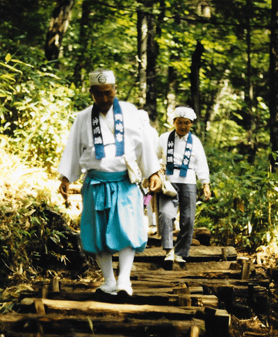
A variation on pilgrim wear
Mr. & Mrs. Pilgrim
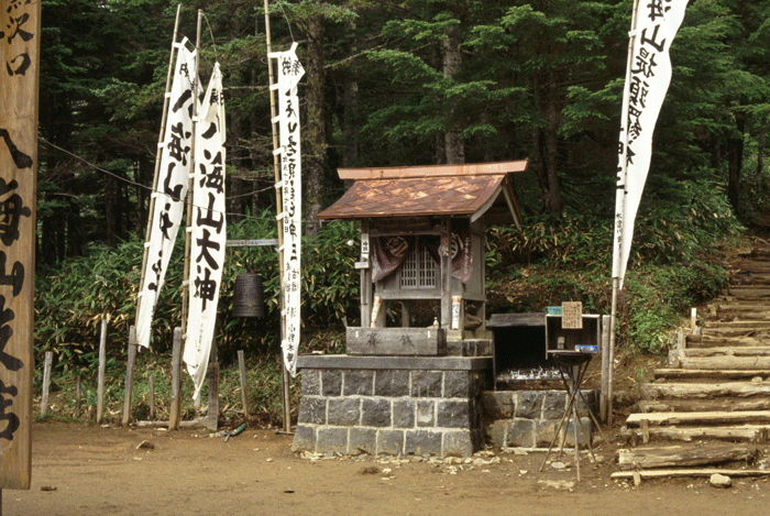
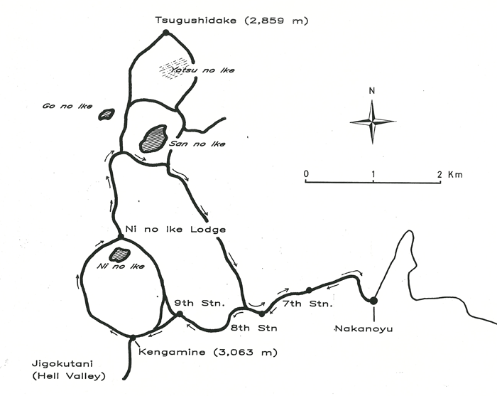
Passing small rest places and the 7th Station, the
path turns in to a typical rocky mountain trail
and within an hour
and a half the 8th Station is reached.
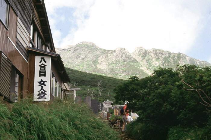
| The beauty of the mountain becomes immediately apparent as you reach this point, as you are beyond the tree line and the entire ridge and the Kengamine peak are visible ahead, along with the lodges and stopping points seemingly balanced precariously on the mountain side. |
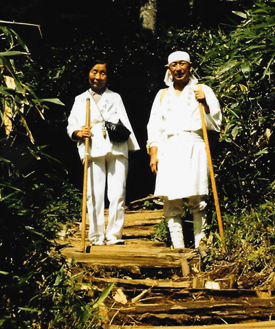
What the best dressed pilgrim is wearing this year!
.

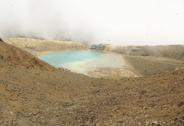
| The climb becomes steeper now, but the peak seems well within grasp and we reached the 9th Station in a matter of fifty minutes. Now begins the last haul up to the top, past the beautiful turquoise coloured "Ni-no-Ike" pond on the right until Kengamine itself, 3,063m is reached. |
.

.
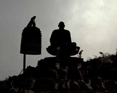

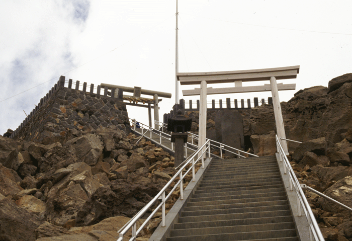
| Well constructed stone steps lead up to the shrine at the top, and the surrounding views are spectacular. We reached the top at 12 noon, the climb to 3,063m taking only 3 hours. |


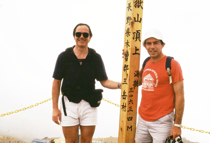
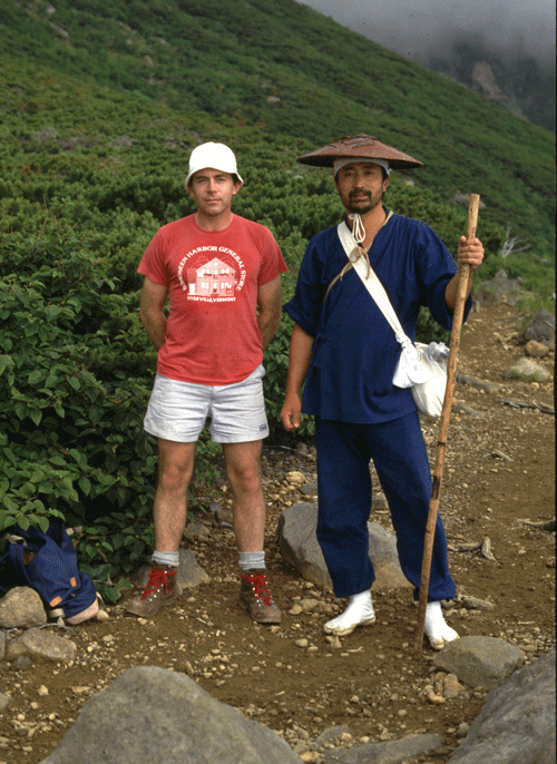
Mick and Phil
| After lunch at the top we decided to take the ridge route round Ichi-no-Ike to No-no-Ike Lodge. Finding the start of this path is not easy and you have to join it at the shrine area at the top of Kengamine, to the left hand side of a small shop selling religious souvenirs. The path drops down to a saddle as you walk over a grey volcanic clay material, and the volcanic nature of the mountain is brought home to you clearly by the roar of the blow hole in nearby Jigokutani (Hell Valley) and the smell of sulphur. |
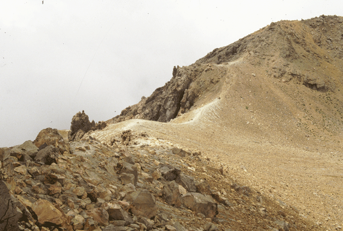
| Rising up from this saddle lies a beautiful ridge walk leading to Ni-no-Ike Lodge and on to San-no-Ike. This is a really pleasant walk with rock scrambling and not too much climbing, until you eventually rise to another saddle overlooking the much larger pond, San-no-Ike. The path takes off to the left over a wooden trestle as it traverses the slope and drops down to San-no-Ike. |

.

| Again the area is of special religious significance, and pilgrims clad in white were chanting sutras at a small shrine at the edge of the pond. It was here that we met up with a mountain priest clad in white tabi, blue tunic and urushi hat whom we accompanied on the walk back to the 8th Station. |
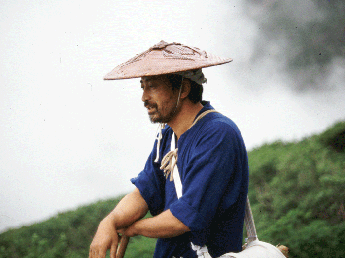
Yamabushi

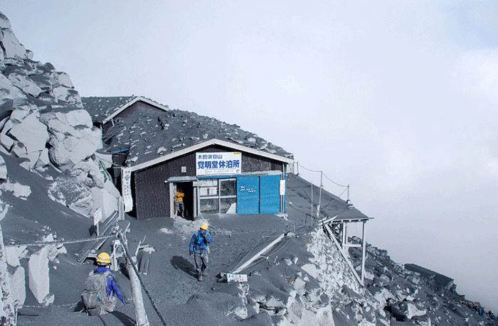
The trail from San-no-Ike back to the 8th Station was rather special, traversing the hillside and dropping down through valleys and cuttings. We were glad to be led by the mountain priest, who was expert at gliding over the rocks and the uneven path and gave us confidence that we were, in fact, heading in the right direction. Dropping down over rickety wooden trestles clinging to the hillside we eventually came to a small snow bridge across a steep gully. The experience of the mountain priest told, as he made sure that we crossed this delicate looking snow bridge one at a time. It was quite surprising to see snow there in early August, but it attests to the cool temperatures maintained in the shady valleys at these altitudes.It was almost a disappointment to reach the 8th Station, as we realised that our walk for the day was almost over. Green tea was shared with our newly made mountain priest friend in the 8th Station lodge, before we left for the hour long walk back to Nakanoyu. |

Returning to Tokyo was easier than the outward journey as we now had the lie of the land. Dropping down to Route 19 we headed north to the Shiojiri Interchange on the newly constructed Nagano Expressway, and were soon speeding along the Chou Expressway on our way home.Nine hours in the car and seven climbing mountains is a long day, but we felt an enormous sense of achievement and marvelled at the ease at which the walk took us to the 9,000 feet level and provided such interest. A walk definitely to be repeated, and to be extended to include Tsugushidake at 2,859 m at the far end of the ridge. |
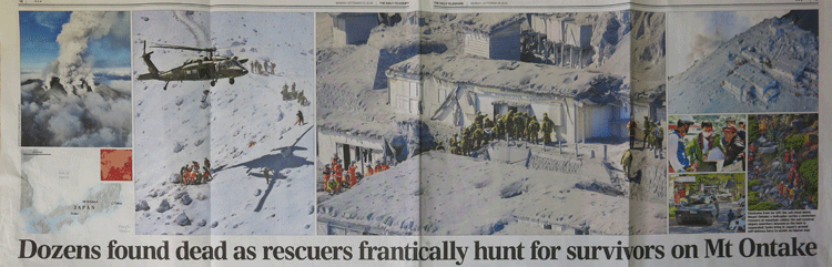
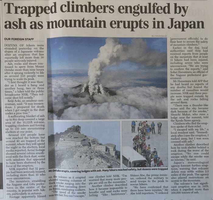
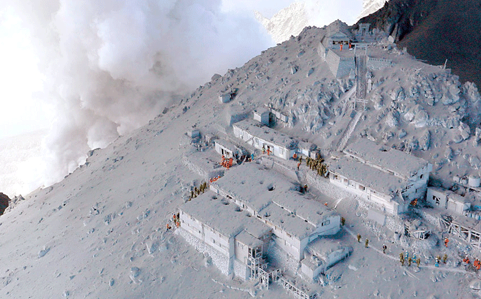
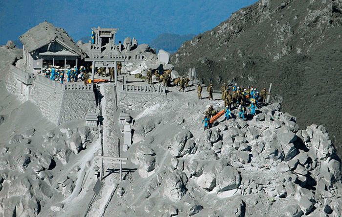
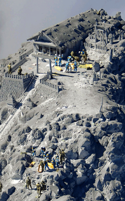
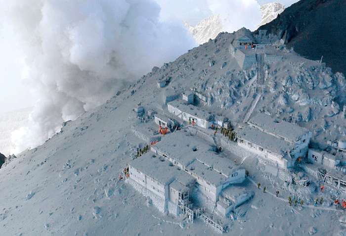
Disaster - September 2014
| On 27th September 2014 Mount Ontake erupted unexpectedly trapping many hikers on the mountain. The result was catastrophic with 51 people being killed. |